The Lurie Garden now has an incredibly cool interactive map on their website! If this does not thrill you to your very core, then I pity your torpid soul.
I learned about the map from reading a post, The Challenges and Rewards of Mapping the Natural Garden, on the Lurie Garden website. The post was written by Peter Slothower, the Lurie’s Assistant Horticulturalist and Gustafson Guthrie Nichol Public Garden Apprentice. Click here to read the post for yourself – it’s fascinating stuff.
One of the great things about this map is that you can see what is blooming at any point during the growing season. You can also watch the garden change before your eyes over whatever period of time you choose.
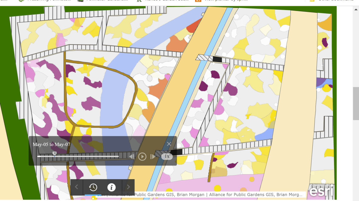
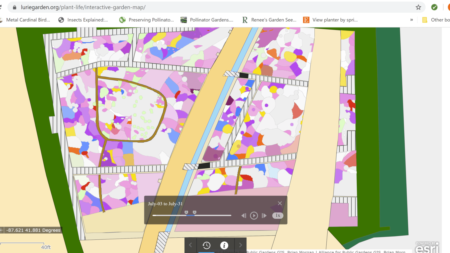
For example, here’s the north end of the Light Plate in early May.
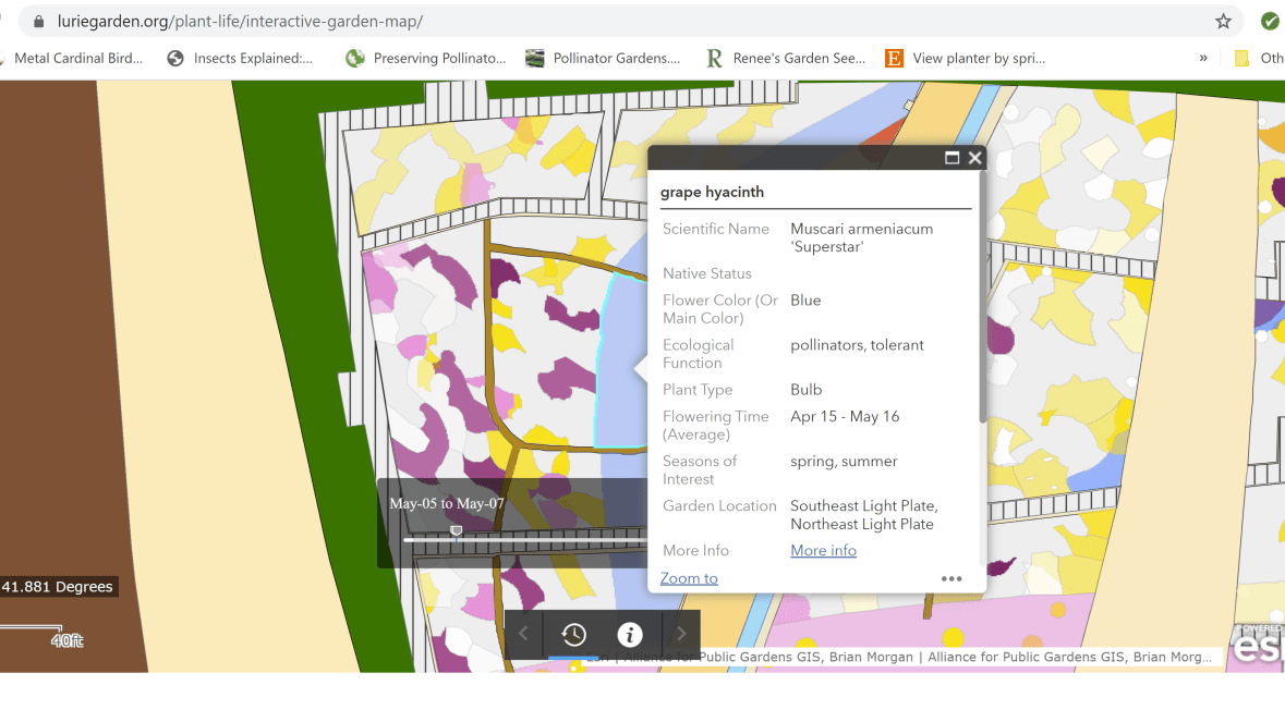
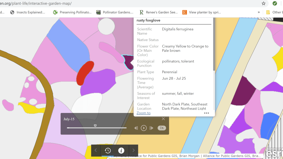
Click on one of the colored shapes and you’ll get the name of the plant in bloom in that space, along with other information.
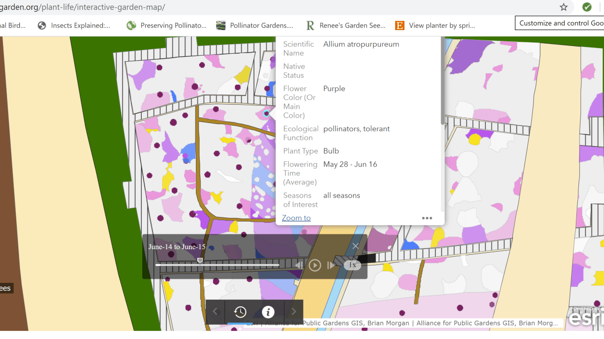
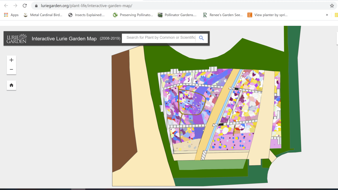
Here’s the same part of the garden in mid-June.

This map was developed over the past year using something called a dynamic geographic information system. I have no idea what that is, but I think it involves drones. The idea is to allow the designers to have a more precise idea of how the garden changes over time, and using that more exact information to determine what edits or additions are needed. It also allows the staff to more effectively inventory what is growing throughout the garden.

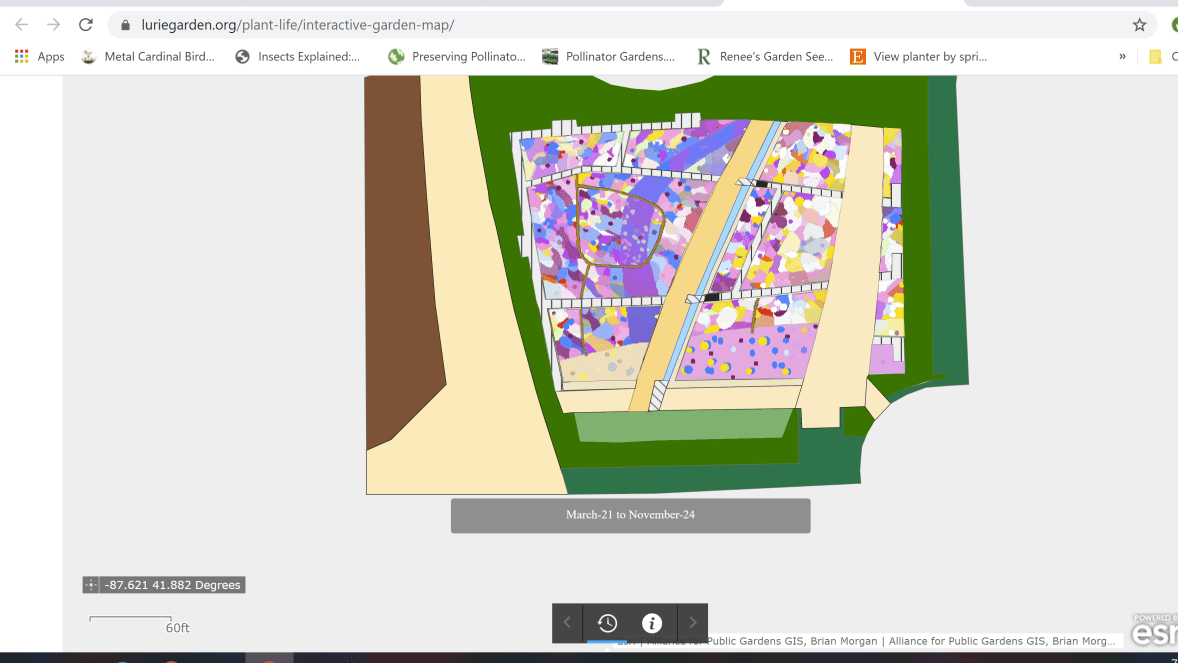
The map’s controls enable you to examine a smaller area more closely.
Or you can just pinch your screen.
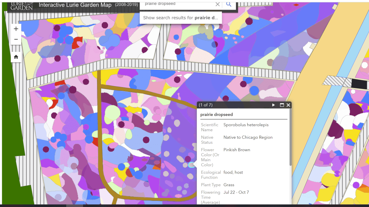
As of now the map does not provide information about foliage. However, it does indicated the bloom times and locations of the Lurie Garden’s many grasses.
The map is marked “Beta”, which I’m told is a sort of warning to expect a bit of awkwardness of use. However, and I say this as a total computer klutz, I found it to be fairly intuitive. The view finder was the only thing I couldn’t figure out, but it’s really not essential.
So if I seem to disappear from view for the next couple of months, just know that I am playing with the Lurie Garden’s interactive map. I’m just a tiny bit worried that I won’t be able to tear myself away in order to work in our actual garden when the spring thaw hits.


It does thrill me. It ran a little slow at first, but nothing you couldn’t work with. There are obvious commercial applications in gardens that sell plants or charge for entry – visitors can identify flowers they most like and check facts about them. It could help with forecasting sales and this year’s flowering times combined with long range weather forecasts and weather observations. I could imagine if it became popular, it would tend to condense visitor traffic in (eg) a rose garden, when there are peaks and troughs of flowering. I am wondering how much something like this would cost. Is this a wealthy garden?
So I checked with my friend Jo ana Kubiak who is on staff at Lurie and it turns out this was not very expensive, just extremely labor intensive. No drones were involved, just lots of staff time over the winter months. Lots of the data had already been collected and just had to be transferred to the map. Also, I should mention that while Lurie Garden has received a generous endowment and other funding, expenditures are managed very conservatively.
It seems a person would want this for any garden one gets to visit often.
Certainly any large, complex garden.
That is amazing! And what a great lot of work it must have been! I’ve longed to have something like this (albeit way more low tech) for my garden- now I have serious map envy. Thanks for sharing it with us!
I also have serious map envy.
Sounds like a great use of current technology!
I think so.
I spent some time with it, and while I really have no use for the interactive map, I did find it extremely useful in another way. Being able to sort by category (e.g., native, white, spring) is a wonderful tool. I was able to identify a couple of flowers I found on a prairie near Kansas City a couple of years ago, and bookmarked the site for future use. That way of being able to sort might be workable even for less well funded and well staffed organizations.
Yes, the plant finder is also extremely helpful with figuring out what’s going on in the garden.
I haven’t been to the Lurie Garden, though one can appreciate this kind of interactive map for any garden. Well done to those who put it together. One day I will get there.
I hope you do!
It’s a great thing but I’d appreciate it more if I could get there.
Perhaps one of these days …
That is really neat! I have thought about trying to figure out how to do something like that for the farm when writing wildflower pages. Trying to explain where they were spotted to someone unfamiliar with the layout would be great with a map. It would be great for me, too, because sometimes I can’t find what I found before. Thanks for sharing!
I’d be happy to see the Lurie Garden in person… but meanwhile …enjoy the interactive map!
Thanks, I will!
Oh nooo… 🙂
The map is very interesting and the local people must find it thrilling, but now I feel so stupid:
My son stayed in one of the hotels next to Millennium Park and I didn’t understand it was where this garden is – even though you have published wonderful posts about it.
It is winter, but he could have taken some photos for me. 🙂
Thank you for sharing!
Oh, that’s a shame! Maybe he will come back and have another chance!
Wow, you not only have access to that wonderful garden, but can now plan your visit precisely too! Have fun with the map. The links were really interesting – thanks. 😃
Oh, I am definitely having fun with the map. Very diverting.
That is absolutely brilliant! All large gardens should have one. xxx
Definitely!